-
District Related
Introduction to District
History and tradition
-
Administration
Deputy Commissioner
Deputy Commissioner\'s Office
Additional Deputy Commissioners
Officers and Staffs
Branch related
Important information
Innovation
District e-Service Center
Other
-
District Administration Barguna Innovation Action Plan
-
Multimedia Classroom Information
-
Public hearing
-
জেলা পর্যায়ে কর্মকর্তাবৃন্দ
-
Public Representatives
-
List of registered marriage registrars in Barguna district (Upazila based)
-
কাজী, ননকাজী এবং হিন্দুবিবাহ নিবন্ধকের তালিকা
-
Action plan to stop child marriage, Barguna
-
District Administration Barguna Innovation Action Plan
-
Local Government
Zela parishod
Municipality
Upazila Parishad
-
Govt. Offices
Law-discipline and security issues
Education and Cultural Affairs
-
District Non-formal Education Bureau, Barguna
-
District Sports Office, Barguna.
-
District Education Office, Barguna
-
Bangladesh Shishu Academy, Barguna
-
জেলা সরকারী গণগ্রন্থাগার
-
District Shilpakala Academy
-
District Education Engineering Office
-
Barguna govt. polytechnic Institute
-
District Primary Education Office
-
Textile Vocational Institute, Barguna
-
Primary Teachers Training Center
Agriculture and food related issues
-
Deputy Director\'s Office, Department of Agricultural Extension, Farmbari, Barguna.
-
District Food Controller\'s Office, Barguna
-
District Livestock Officer\'s Officeর্মকর্তার কার্যালয়
-
District BADC (IR) Office
-
District Small and Cottage Industries Corporation Office
-
বাংলাদেশ নিরাপদ খাদ্য কর্তৃপক্ষ
-
District Agriculture Marketing Office
-
Office of the District Fisheries Officer, Barguna
-
Seed marketing, BADC, Barguna
-
Bangladesh Food Safety Authority, District Office, Barguna
-
District seed certification office
-
District Artificial Insemination Center, Barguna
Engineering and communication
-
Public Works Department, Barguna
-
Water Development Board, Barguna
-
Road Division, Barguna
-
Department of Public Health Engineering
-
Barguna main post office
-
BTCL, Barguna
-
Local Government Engineering Department, Executive Engineer\'s Office
-
District Relief & Rehabilitation Office
-
Doict
-
Department of Health Engineering
-
Barguna Electric Supply, WZPDCL, Barguna
-
BIWTA
About Human Resources Development
-
District Employment and Manpower Office, Barguna
-
District Women Affairs Officer\'s Office,
-
District Co-operative Office, Barguna
-
District Social Welfare Office, Barguna
-
Bangladesh Rural Development Board
-
Department of Youth Development, Barguna
-
Islamic Foundation, Barguna
-
District Hindu Religious Welfare TrustOffice
-
hospital social services office, barguna
-
TTC
-
প্রবেশন অফিসারের কার্যালয়, বরগুনা
-
Integrated Visually Impaired Educational Institution, Barguna
-
Government Child Family (Boy), Barguna
-
Protibondhi seba o sahajjo kendro, barguna
-
Youth Training Center DYD Barguna
Government Services Agency
Other government offices
-
District Accounts Office
-
District Palli Daridro Bimicon Foundation Office
-
District Passport Office
-
Department of Environment
-
Office of the Deputy Commissioner of Taxation, Barguna
-
District Customs Excise and VAT Office
-
District Election Office, Barguna
-
District Information Office, Barguna
-
Forest Division
-
District Savings Office
-
Probation Office
-
District Statistics Office, Barguna
-
ZP
-
District Non-formal Education Bureau, Barguna
-
Other organizations
Educational Institution
Organization / organization
-
E-services
Mobile Apps
District E-Service Center
National e-Seba
Union Information and Services Center
- নাগরিক সেবাসমূহ
-
Gallery
------------------
-
My Gov
- Information ask
-
District Related
Introduction to District
History and tradition
-
Administration
Deputy Commissioner
Deputy Commissioner\'s Office
Additional Deputy Commissioners
Officers and Staffs
Branch related
Resolutions of Meeting
Important information
Innovation
District e-Service Center
Other
- District Administration Barguna Innovation Action Plan
- Multimedia Classroom Information
- Public hearing
- জেলা পর্যায়ে কর্মকর্তাবৃন্দ
- Public Representatives
- List of registered marriage registrars in Barguna district (Upazila based)
- কাজী, ননকাজী এবং হিন্দুবিবাহ নিবন্ধকের তালিকা
- Action plan to stop child marriage, Barguna
-
Local Government
Zela parishod
Municipality
Upazila Parishad
Local government representative
-
Govt. Offices
Law-discipline and security issues
Education and Cultural Affairs
- District Non-formal Education Bureau, Barguna
- District Sports Office, Barguna.
- District Education Office, Barguna
- Bangladesh Shishu Academy, Barguna
- জেলা সরকারী গণগ্রন্থাগার
- District Shilpakala Academy
- District Education Engineering Office
- Barguna govt. polytechnic Institute
- District Primary Education Office
- Textile Vocational Institute, Barguna
- Primary Teachers Training Center
Agriculture and food related issues
- Deputy Director\'s Office, Department of Agricultural Extension, Farmbari, Barguna.
- District Food Controller\'s Office, Barguna
- District Livestock Officer\'s Officeর্মকর্তার কার্যালয়
- District BADC (IR) Office
- District Small and Cottage Industries Corporation Office
- বাংলাদেশ নিরাপদ খাদ্য কর্তৃপক্ষ
- District Agriculture Marketing Office
- Office of the District Fisheries Officer, Barguna
- Seed marketing, BADC, Barguna
- Bangladesh Food Safety Authority, District Office, Barguna
- District seed certification office
- District Artificial Insemination Center, Barguna
Engineering and communication
- Public Works Department, Barguna
- Water Development Board, Barguna
- Road Division, Barguna
- Department of Public Health Engineering
- Barguna main post office
- BTCL, Barguna
- Local Government Engineering Department, Executive Engineer\'s Office
- District Relief & Rehabilitation Office
- Doict
- Department of Health Engineering
- Barguna Electric Supply, WZPDCL, Barguna
- BIWTA
About Human Resources Development
- District Employment and Manpower Office, Barguna
- District Women Affairs Officer\'s Office,
- District Co-operative Office, Barguna
- District Social Welfare Office, Barguna
- Bangladesh Rural Development Board
- Department of Youth Development, Barguna
- Islamic Foundation, Barguna
- District Hindu Religious Welfare TrustOffice
- hospital social services office, barguna
- TTC
- প্রবেশন অফিসারের কার্যালয়, বরগুনা
- Integrated Visually Impaired Educational Institution, Barguna
- Government Child Family (Boy), Barguna
- Protibondhi seba o sahajjo kendro, barguna
- Youth Training Center DYD Barguna
Government Services Agency
Other government offices
- District Accounts Office
- District Palli Daridro Bimicon Foundation Office
- District Passport Office
- Department of Environment
- Office of the Deputy Commissioner of Taxation, Barguna
- District Customs Excise and VAT Office
- District Election Office, Barguna
- District Information Office, Barguna
- Forest Division
- District Savings Office
- Probation Office
- District Statistics Office, Barguna
- ZP
-
Other organizations
Educational Institution
Organization / organization
-
E-services
Mobile Apps
District E-Service Center
National e-Seba
Union Information and Services Center
-
নাগরিক সেবাসমূহ
অবিবাহিত সনদ
Minorities Charter
-
Gallery
------------------
-
My Gov
-
Information ask
প্রদানযোগ্য তথ্য
অপ্রদানযোগ্য তথ্য
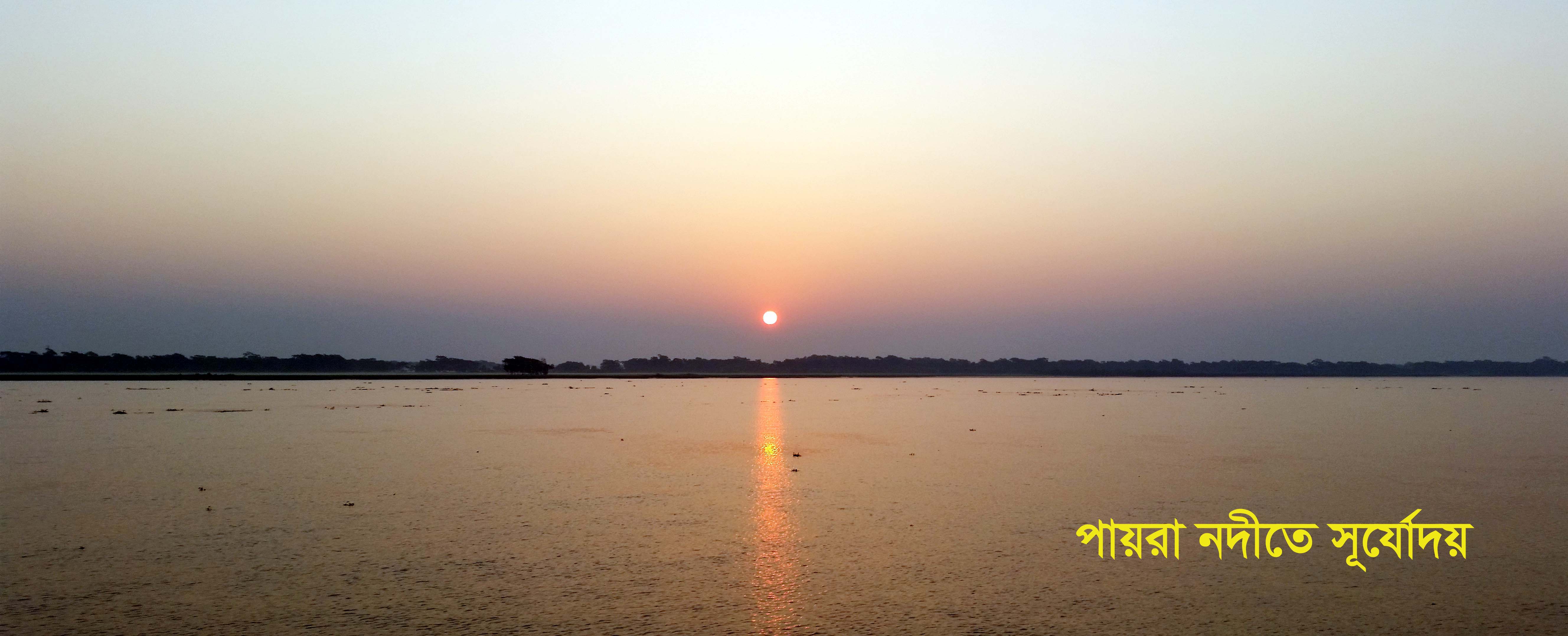
Barguna district is located 11 © হতে above sea level in the southernmost part of Bangladesh between 21 ৫০ 50 ০ 05 হতে and 23 ০ 04 ১০ 10 উত্তর north latitude and 69 ৫ 59 ৫০ 50 হ 91 ০ 04 ৮৮ 6 পূর্ব east longitude. Barguna district is bounded on the north by Jhalokati, Barisal, Pirojpur and Patuakhali districts, on the south by Patuakhali district and Bay of Bengal, on the east by Patuakhali district, on the west by Pirojur and Bagerhat districts. Notable rivers of the district are Payra, Bishkhali and Baleshwar. The average annual temperature is 33.3 degrees Celsius and the minimum is 12.1 degrees Celsius. The annual rainfall of the district is 2506 mm.
Although there is no definite history of the name Barguna, it is known that the place was known as Bara Gona because the timber traders from the north used to come here to fetch timber and cross the Kharsrota Khakdon river for favorable flow or big gon. According to some, the place was called Barguna because the boat had to be crossed by pulling the guna (gorge) against the current. Some say that Barguna is named after a powerful Rakhine resident named Barguna. Others say that the place is named after a Bawali named Barguna.
The inter-district internal communication system with the coastal district of Barguna is not very well developed. In case of road communication, communication is quite time consuming as there are ferry crossings at different places. Although there is a communication system on the river, there are not enough vessels of the desired quality in time.
The Barisal divisional town can be reached by road from Barguna Sadar via Patuakhali via Payra, Lebukhali and Kirtankhola river ferries. The total distance of this route is about 90 km and it takes about 04 hours. At present, the Barguna-Betagi-Mirzagajna-Bakergajna-Dapadapiya road is being used as an alternative to the Barisal divisional town. Although this road takes relatively less time, the road is being used less as the renovation work is going on.
Barguna and Jhalokati are connected by water. Apart from this, you can go to Jhalokati via Barisal by road which is very expensive and time consuming. From Barguna to Kakachira-Shatkar-Mathbaria-Bhandaria-Pirojpur by road to Bagerhat and Khulna divisional town.
It is possible to reach Barisal and Khulna divisional cities from Barguna district and go anywhere in the country.
The inter-upazila communication system of Barguna district is quite developed at present. It takes about 00-50 hours to reach Amtali Upazila by crossing the Payra river ferry from Barguna district headquarters. Taltali Upazila can be reached directly by road from Amtali Upazila so that it takes about 1 hour. Besides, Barguna Sadar Upazila has direct road connection with Betagi Upazila, which takes about 01-00 hours. There is road communication from Barguna district headquarters to Patharghata and Bamna upazilas through Baraitala-Bainchatki ferry crossing. It takes 01-30 hours and 02.00 hours respectively.
Planning and Implementation: Cabinet Division, A2I, BCC, DoICT and BASIS


